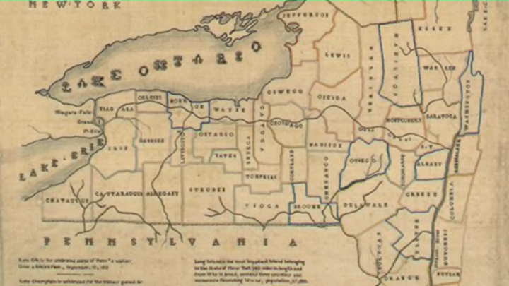
Show & Tell: A Needlepoint Map Sampler

This 1829 sampler map of New York State, made by 14-year-old resident Elizabeth Ann Goldin, illustrates Goldin’s facility with the cross, stem, chain, back, and four-sided stitches. The sampler neatly combines a lesson in sewing with one in cartography; similar sampler projects from the late 18th and early 19th centuries required students to stitch maps of countries, regions, continents, or the world. Like this pre-printed British sampler from 1811, which calls on girls to fill out a diagram of the solar system, the geographical sampler shows how people in the early 19th century increasingly expected educated young women of the upper classes in Britain and the United States to combine prowess in the domestic arts with a modicum of knowledge about the greater world.
Elizabeth Ann Goldin’s sampler is also an artifact of an American educational philosophy that called for young women to know something about the geography of the new nation. In the 1820s, teacher and writer Emma Willard, then the head of the Troy Female Seminary in New York State, advocated geographical education for her female students, going so far as to author and co-author several textbooks optimized for use with that population. Educators influenced by Willard had students hand-draw maps (like this beautiful atlas, made by Vermont student Frances Henshaw in 1828) in order to more fully understand cartographic principles. The Goldin New York State sampler, produced a year after Henshaw’s atlas, seems of a piece with this school of pedagogical thought.
Writing about the sampler, Jennifer Johnson of the Cooper Hewitt observes that Goldin “include[d] text celebrating American naval victories against the British on Lakes Champlain and Erie” during the War of 1812—a patriotic approach particularly appropriate for a child born in the young republic in 1814. Johnson suggests that Goldin may have followed this 1824 New York State map by Anthony Finley as a guide for her design. “The two maps are not only visually similar,” Johnson observes, “but Finley’s map lists the population of New York in the year 1820, a statistic also included on Elizabeth’s sampler.”